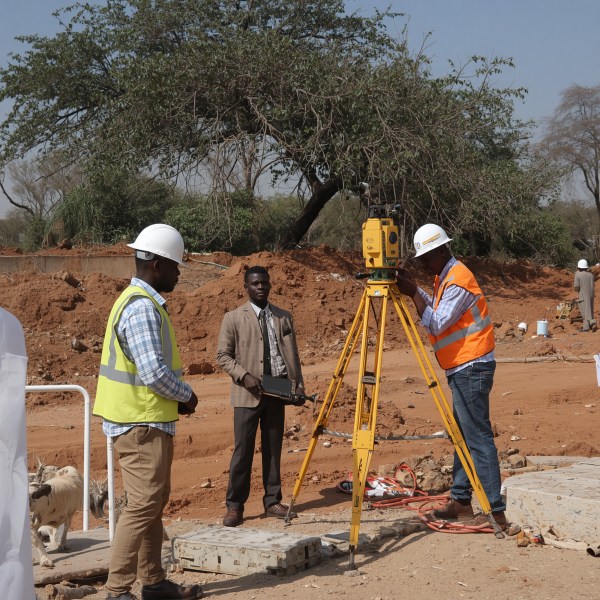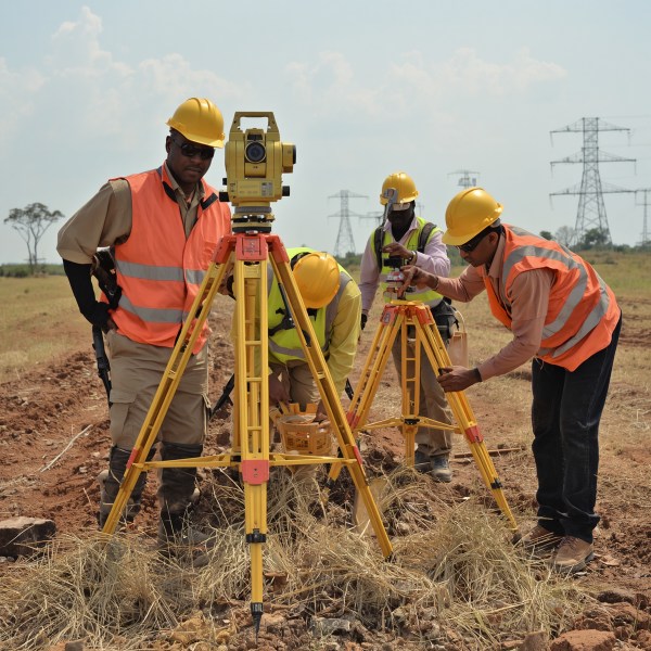
Engineering and Construction Surveys Kenya: Precision That Builds Trust
Every successful project starts with accurate data. Whether you're a developer in Nairobi breaking ground on a high-rise, a homeowner in Kisumu building your dream home, or a government agency rolling out infrastructure, the quality of your surveys determines the quality of your results. At Bridgepoint Engineers Limited, we deliver engineering and construction surveys Kenya demands—precise, reliable, and backed by licensed expertise.
Why Engineering Surveys Matter for Your Project
Skipping or skimping on surveys can lead to costly mistakes: boundary disputes, structural failures, delays, and budget overruns. Our engineering surveys Nairobi and across Kenya eliminate guesswork. We use modern equipment and time-tested methods to map terrain, define boundaries, and guide construction with millimeter accuracy.
Our Comprehensive Survey Services
Topographical Survey Kenya
A topographical survey is the foundation of any design. We capture natural and man-made features—elevations, trees, utilities, roads—and deliver detailed contour maps. Whether you're planning a residential subdivision or an industrial park, our topographical surveys give architects and engineers the ground truth they need.
Setting Out Survey Kenya
Once designs are approved, construction must align perfectly with plans. Our setting out services transfer every column, wall, and road from drawings to the ground. We stake out positions with high accuracy, reducing rework and keeping your project on schedule. This is particularly critical for complex developments in Mombasa and Nairobi where space is tight.
As-built Survey Kenya
After construction, an as-built survey records what was actually built. This is essential for compliance, handover, and future renovations. Our as-built surveys document deviations from the original design, providing a reliable record for facility management.
Cadastral and Boundary Surveys
Land ownership disputes can stall any project. Our cadastral surveys establish legal boundaries with precision. Licensed land surveyors Kisumu and Nairobi conduct demarcation services that stand up in court. We also offer land demarcation services Kenya to secure your property rights.
Volume Surveys for Earthworks
For excavation and fill projects, accurate volume calculations prevent cost overruns. Our volume surveys use drone or total station data to compute cut and fill quantities, giving you tight control over budgets.
Why Bridgepoint Engineers for Engineering Surveys Nairobi & Mombasa
Licensed and Experienced
Our team consists of licensed surveyors Kenya with decades of combined experience. We understand local regulations, terrains, and challenges—from the coastal soils of Mombasa to the highland slopes of Nairobi.
Affordable Engineering Surveys Kenya
We believe precision shouldn't be a luxury. Our pricing is transparent and competitive. We tailor packages for homeowners, small developers, and large agencies, ensuring you get value without compromising quality.
Advanced Technology
We combine GNSS, robotic total stations, and drones to deliver fast, accurate results. For large-scale infrastructure surveys Kenya, we deploy geodetic surveys that tie your project to national reference networks.
Our Survey Process: From Discovery to Delivery
Discovery
We start by understanding your project goals, site conditions, and deliverables. This helps us choose the right survey methods and equipment.
Planning
We design a survey plan that covers all necessary data points, regulatory requirements, and timelines. We coordinate with your team to minimize disruptions.
Execution
Our field teams collect data using best-in-class instruments. We monitor quality in real time to ensure accuracy from the first measurement.
Assurance
Data is processed, checked, and delivered in your preferred format—CAD, GIS, PDF, or survey report. We also provide on-site support to answer questions.
Frequently Asked Questions
What is the difference between a topographical survey and a cadastral survey?
A topographical survey maps physical features like contours, buildings, and vegetation. A cadastral survey focuses on property boundaries and legal ownership. Both are essential for different stages of development.
Do I need a setting out survey if I have a site plan?
Yes. A site plan shows design intent, but a setting out survey translates that into physical stakes on the ground. This ensures the contractor builds exactly where intended, preventing costly errors.
How long does a typical construction survey take in Kenya?
Timelines vary based on site size and complexity. A small residential plot in Nairobi can be surveyed in one to two days, while a large infrastructure project in Mombasa may take several weeks. We provide a schedule during the planning stage.
Are your surveyors licensed for land demarcation services Kenya?
Absolutely. Our surveyors are licensed by the Institution of Surveyors of Kenya (ISK) and meet all regulatory requirements for cadastral and boundary surveys.
Do you offer geodetic surveys for large infrastructure projects?
Yes. We perform geodetic surveys that establish precise coordinates and elevations over large areas, essential for roads, pipelines, and power lines. Our infrastructure surveys Kenya comply with national geodetic standards.
Ready to start your project with confidence? Contact Bridgepoint Engineers Limited for engineering and construction surveys Kenya you can bank on. Our team is ready to serve you from Nairobi, Mombasa, Kisumu, and across the country.
Frequently Asked Questions
What is the difference between a topographical survey and a cadastral survey?
A topographical survey maps physical features like contours, buildings, and vegetation. A cadastral survey focuses on property boundaries and legal ownership. Both are essential for different stages of development.
Do I need a setting out survey if I have a site plan?
Yes. A site plan shows design intent, but a setting out survey translates that into physical stakes on the ground. This ensures the contractor builds exactly where intended, preventing costly errors.
How long does a typical construction survey take in Kenya?
Timelines vary based on site size and complexity. A small residential plot in Nairobi can be surveyed in one to two days, while a large infrastructure project in Mombasa may take several weeks. We provide a schedule during the planning stage.
Are your surveyors licensed for land demarcation services Kenya?
Absolutely. Our surveyors are licensed by the Institution of Surveyors of Kenya (ISK) and meet all regulatory requirements for cadastral and boundary surveys.
Do you offer geodetic surveys for large infrastructure projects?
Yes. We perform geodetic surveys that establish precise coordinates and elevations over large areas, essential for roads, pipelines, and power lines. Our infrastructure surveys Kenya comply with national geodetic standards.